

Craig-las [Tyrrau Mawr]
Good walks are even better shared.
Overview
Craig-las [Tyrrau Mawr]
Nestled in the stunning Snowdonia National Park, Craig-las, also known as Tyrrau Mawr, rises proudly at 800 meters above sea level. It's renowned not just for its height but for the breathtaking views and varied geological features that make it a deserving reward for those brave enough to make the trek.
Geology
The mountain's intriguing geology includes volcanic rocks, predominantly rhyolite. These rocks contribute both to the mountain's dramatic cliffs and ancient whispers of geological tales. The surrounding valleys carved by glaciers offer a picturesque backdrop that's perfect for photography or simply soaking in the beauty of nature.
Routes
Two popular routes lead eager hikers to the summit:
- Craig-las from Cwm Cywarch: A moderate trail that spans approximately 6.5 km and takes about 3.5 hours to navigate. Starting in the beautiful Cwm Cywarch, this route provides a gentle introduction to the mountain’s splendour.
- The Watkin Path to Craig-las: This more challenging route stretches about 8.0 km and requires around 4 hours to complete. It utilizes the well-trodden Watkin Path, enabling hikers to enjoy dynamic vistas.
Summit Features
On reaching the summit, adventurers will be greeted by a memorable stone cairn and a trig point. It’s customary for hikers to leave a small stone atop the cairn as part of a longstanding tradition—just don’t forget to make a wish!
Terrain Type
Expect a rocky yet exhilarating experience on Craig-las—with grassy patches sporadically appearing to soften your steps. Perfect for seasoned hikers!
Views
The views from Craig-las are nothing short of spectacular. With landmarks such as Cadair Idris and the majestic valley of Cwm Cywarch in sight, hikers are often left gasping in awe. The best times to visit for views that leave your jaw on the floor are during spring and early autumn, when the heather and foliage are at their most vibrant.
Hazards
A fair warning to thrill-seekers: the terrain is steep and can be slippery, especially if the weather decides to turn on you. Always wear appropriate footwear and keep an eye on the forecast before setting off!
Nearby Summits
Venturing into the area? Don’t miss the chance to bag nearby summits such as Cadair Idris (893m) and Y Gamriw (847m), both of which add to the allure of Snowdonia’s mountainous landscape.
Access
Most hikers head to Craig-las from Cwm Cywarch, where parking is readily available. However, accessing public transport can be tricky; buses from Machynlleth to nearby villages will require a bit of planning. The nearest town, Dinas Mawddwy, offers a range of small shops and cafes that cater to hungry hikers.
Facilities
Dinas Mawddwy is your closest bet for facilities—think quaint cafes and shops eager to replenish your supplies before or after your heart-pumping adventure.
History
The etymology of Craig-las means 'Blue Rock', which resonates through its stunning geographical features. Moreover, the local folklore renders it a culturally significant area, steeped in stories from times gone by.
In conclusion, Craig-las [Tyrrau Mawr] is not just a mountain—you are scaling a piece of natural artistry, wrapped in layers of history and geological intrigue. So lace up those boots, grab your compass (and a bit of chocolate), and embark on a hike that promises views and adventures worth every step!
Happy hiking!
Explore routes near Craig-las [Tyrrau Mawr]
Public walks starting within 80 km of this hill. Nearby does not mean a route reaches the summit; check its map and access before setting out.
Cadair Idris - Pony Path
View route
Mawddach Trail: Penmaenpool to Dolgellau Riverside Return
View route
Mawddach Trail: Penmaenpool to Arthog Estuary Return
View route
Mawddach Trail: Dolgellau to Barmouth
View route
Route planning notes
These notes describe possible approaches, not verified navigable routes or permission to cross land. Check current paths, local access rules and conditions before setting out.
Craig-las from Cwm Cywarch
A scenic climb beginning in the picturesque Cwm Cywarch, featuring lush valleys and thrilling ascent.
The Watkin Path to Craig-las
This route follows the well-known Watkin Path, offering stunning views as hikers make their way to the summit.
Make a day of it, together
Find someone to share the walk with, or organise a day out along a route you like.
Photo Gallery
View all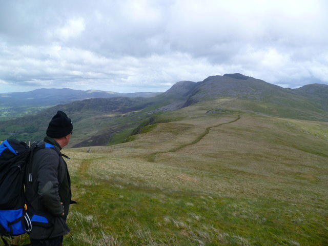 Photo could not load
SH6713 : On Craig -las [Tyrrau Mawr]
Michael Graham
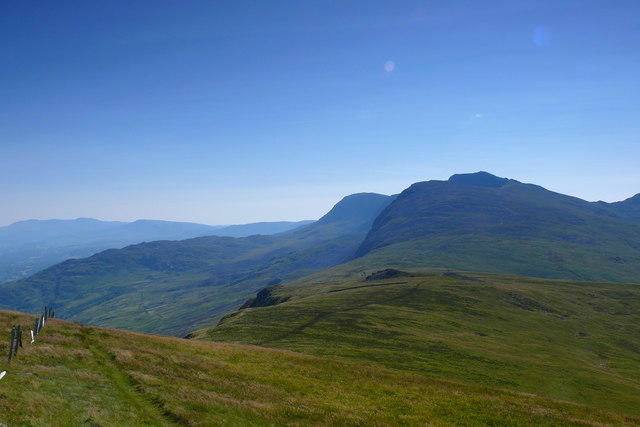 Photo could not load
SH6713 : Copa Craig Las Summit
Ian Medcalf
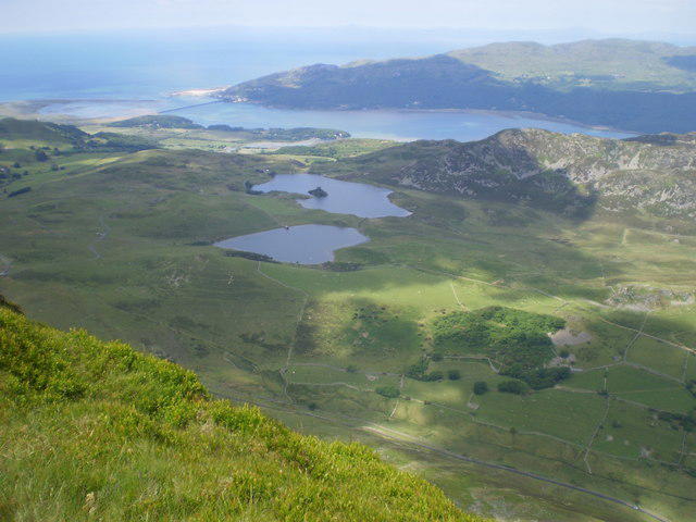 Photo could not load
SH6713 : Barmouth and the Mawddach from Craig-Las.
SIMON DOWNE
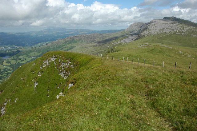 Photo could not load
SH6713 : View east from Tyrrau Mawr
Philip Halling
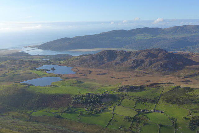 Photo could not load
SH6713 : Looking northwest from Tyrau Mawr
Hansjoerg Lipp
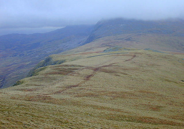 Photo could not load
SH6713 : Eastern approach to Tyrrau Mawr
Nigel Brown
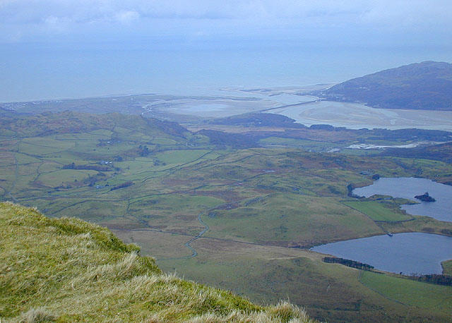 Photo could not load
SH6713 : View west from Tyrrau Mawr (Craig-las)
Nigel Brown
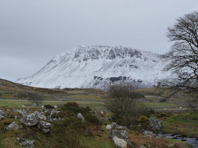 Photo could not load
SH6713 : Snow on Tyrrau Mawr
liz dawson
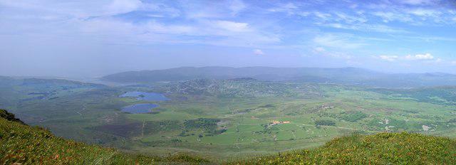 Photo could not load
SH6713 : View from the Tyrrau Mawr
Rudi Winter
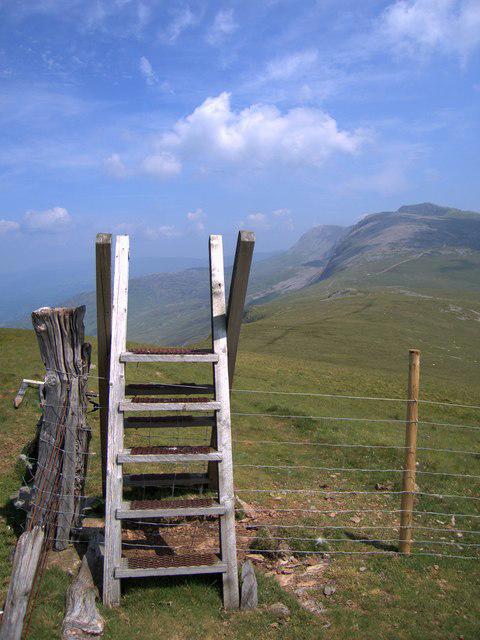
SH6713 : Stile on the Tyrrau Mawr
Rudi Winter
Hill facts and local notes
Classifications
Elevation
661m
2,169 ft
Prominence
101m
Coordinates
52.7035, -3.9594
SH677135
OS Map
124
Explorer: OL23W
At the Summit
The summit features a prominent trig point and a stone cairn, offering a perfect photo opportunity for hikers. Visitors often add a little stone to the cairn as tradition.
Terrain & Geology
The mountain is primarily composed of volcanic rock, particularly rhyolite, which contributes to its rugged appearance. The surrounding area exhibits glacial features, testament to its geological history.
Views & Scenery
From the summit, you can catch a glimpse of the rugged landscape of Merionethshire, including views of Cadair Idris and the beautiful valley of Cwm Cywarch.
History & Heritage
Name Origin
The name 'Craig-las' translates to 'Blue Rock', which is fitting given the mountain’s subtle blue hues in certain light conditions.
Historical Significance
Craig-las has historical significance as part of the ancient landscape, often referred to in local folklore and stories.
Getting There & Facilities
Check current local access restrictions, parking rules and transport timetables before travelling. These notes do not confirm public access to the summit.
Parking
Parking can be found at Cwm Cywarch, providing access to various trails including that to Craig-las.
Public Transport
There is limited public transport; bus services operate from Machynlleth to nearby villages, with the nearest stop at Dinas Mawddwy.
Nearby Facilities
While facilities are limited in the immediate area, Dinas Mawddwy has a few cafes and small shops for replenishing before or after the hike.
Safety Information
Known Hazards
- Steep terrain, changing weather conditions, and rocky paths can pose a risk. Ensure proper footwear and be wary of sudden weather changes.
General Safety Tips
- Check weather conditions before setting out
- Carry appropriate clothing and equipment
- Let someone know your planned route
- Take a map, compass, and GPS device
- Carry emergency supplies: food, water, first aid kit, torch
Hills
Some common questions about the hills answered
Are there group walks up Craig-las [Tyrrau Mawr]?
Many walkers use Walkmates to join or organise walks with others. You can check for group walks around Craig-las [Tyrrau Mawr] through the maps
Are there other walkers around Craig-las [Tyrrau Mawr]?
Activity varies by location and time, but Walkmates lets you see whether others have shared walks or shown interest in this area. Find other people through the walking friends search walking friends for Craig-las [Tyrrau Mawr] search or of course create your own walk for Craig-las [Tyrrau Mawr]
Can I organise a walk to Craig-las [Tyrrau Mawr]?
Yes. If there aren’t any walks listed already, you can create a walk and make it available for others to join.
If you're signed up to Walkmates, you can create a walk to Craig-las [Tyrrau Mawr].
How do I find a walk up this hill?
There are often multiple ways to walk this hill, depending on experience and route preference. Walkmates helps you explore walks and routes that others have shared.
Can I suggest a new route up Craig-las [Tyrrau Mawr]?
Yes. You can suggest or create routes to share with others. Walkmates focuses on the social side of walking, so routes are used to help people organise walks and explore areas together, rather than as detailed navigation tools or route libraries.
Other uses really appreciate knowledgeable walkers sharing their routes. Share your favourite route to Craig-las [Tyrrau Mawr] here
The is an error or something incorrect about this hill. How do I let you know?
We always strive to keep the information on Walkmates as accurate as possible. If you find an error, please let us know through the contact form and we'll aim to correct it as quickly as possible
Community Discussion
Comments
Location
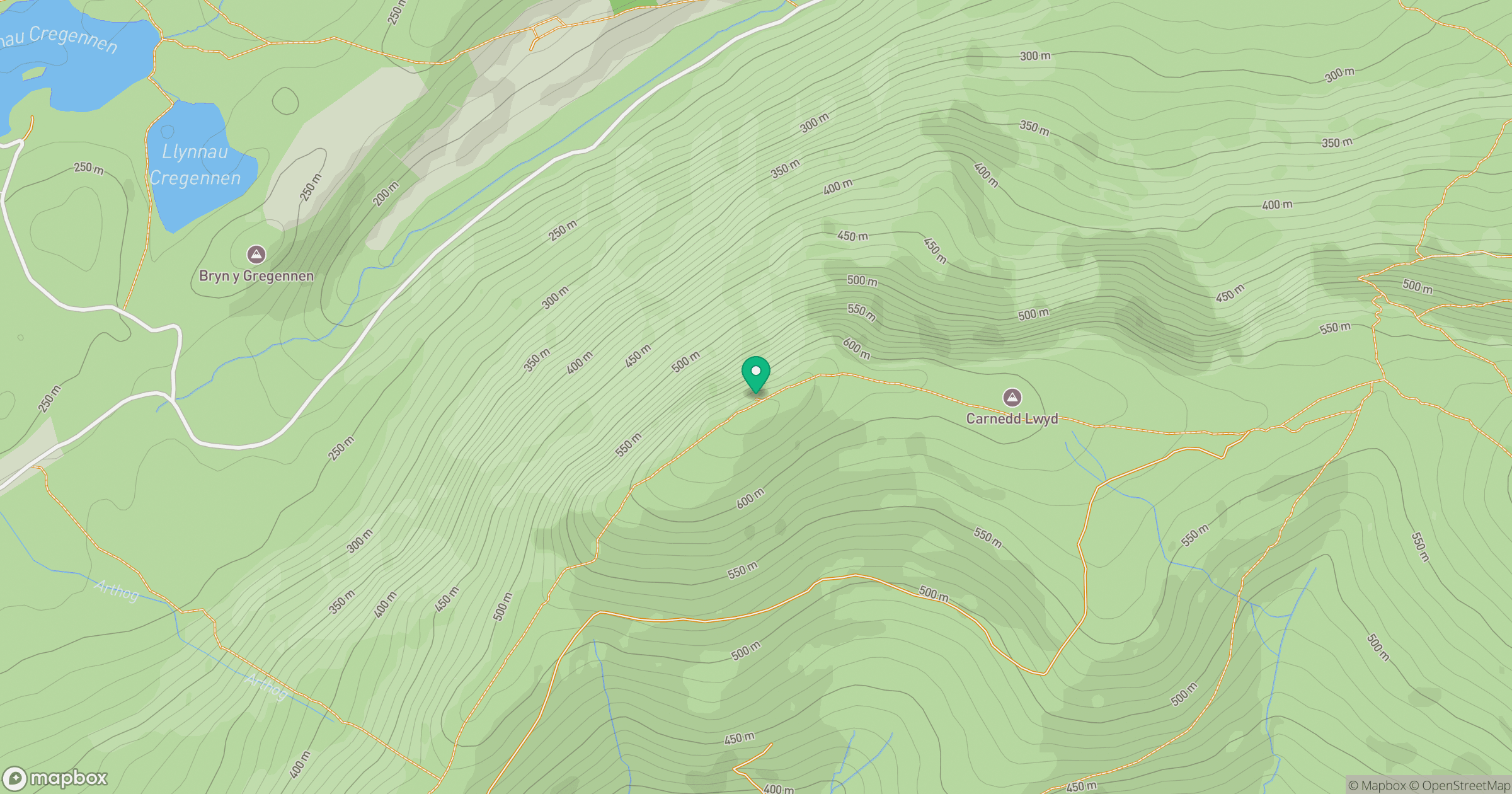
Grid reference: SH677135
View on OpenStreetMapOpens a map in a new tab, centred on the hill.
Hills within 30 km
Straight-line distance, not a walking route or confirmation of access.
Cadair Idris - Penygadair
893m
Y Garn
629m
Rhinog Fawr
721m
Aran Fawddwy
906m
Pumlumon Fawr [Plynlimon]
753m
No comments yet. Be the first.